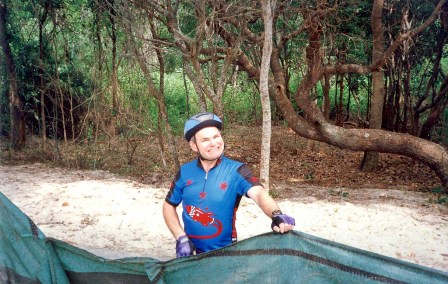
Northern New South Wales
September 12th-17th, 1999
Sunday 12th: Ballina to Lismore (47 km)
Ballina has cafes, bike shops and tourist accommodation as well as several museums. In the tourist centre is an exhibition relating to the Las Balsas raft expedition, in which three rafts left Ecuador in May 1973 and drifted 13 760 km across the Pacific to land at Ballina after 178 days.
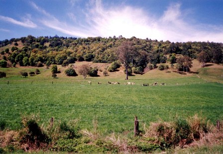
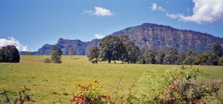
Follow River Street to South Ballina, then go left on Burns Point Ferry Road (3 km) near Ballina quays to the ferry (1 km). Take the ferry across the wide Richmond River and then ride along River Drive which keeps by the east bank with cane fields and the old sugar cane tramway lines to your left. You meet the Pacific Highway (12 km) and go right, crossing the river to Wardell (1 km) which has a shop. From here follow signs to Lismore. The road goes through bush, starts climbing gradually to Meerschaum Vale (6 km) and then more steeply. From Meerschaum continue straight then at the next junction (3 km) go left and at the second junction after this (8 km) turn left again. Look back for views of hills and ocean. In the distance you see the outline of the Nightcap range. You enter orchard country with fruit stalls by the roadside. After Tregeagle (3 km) you have some good descents, then meet the Bruxner Highway (5 km) at Goonellabah, which has shops. Go left for Lismore. The highway has a wide sealed shoulder and descends into the Lismore valley. Lismore (5 km) has a tourist centre with interesting displays about the region's history and bush and a good range of leaflets about the national parks. There are two town walks through native bush within the city limits which have been set up by the Department of Lands and you can also tour the historical buildings.
Monday 13th: Lismore to Nimbin (31 km)
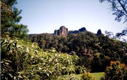
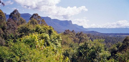
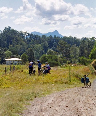
From the centre of Lismore follow Molesworth Street to the Wilson River bridge, then in North Lisinore follow signs to Nimbin which take you onto Nimbin Road (2 km). The road undulates through a succession of valleys with conical hills and patchy forest. Goolmangar (10 km) has a shop. Forested mountains come increasingly into view. I liked the name of the next village, Coffee Camp (10 km), presumably named by the early loggers who took a coffee break there. As you approach Nimbin look out for Nimbin Rocks on your left, curious needle formations on the mountain tops which were formed when Mount Warning was active. Access is from the Kyogle road turnoff (8 km). Nimbin (1 km) nestles beneath the Nightcap range. In 1973 the Aquarius festival led to Nimbin becoming synonymous with counter culture and it has been a haven for hippies since that time. The village is not short on local colour and has a handful of organic food shops, craft shops, cosy cafes and a bush theatre. There are several communes not far from the village. Possible side trips include the steep ride up to Mount Nardi (26 km return) for rainforest walks and views into the Tweed valley, Tuntable Falls and commune (16 km return), and Nimbin Rocks (22 km return) with some rough dirt road.

Tuesday 14th: Nimbin to Murwillumbah (50 km)
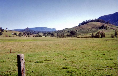
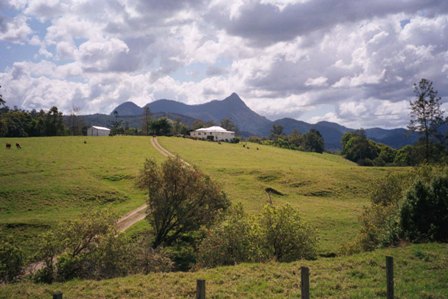
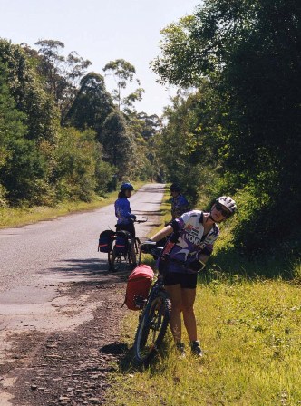
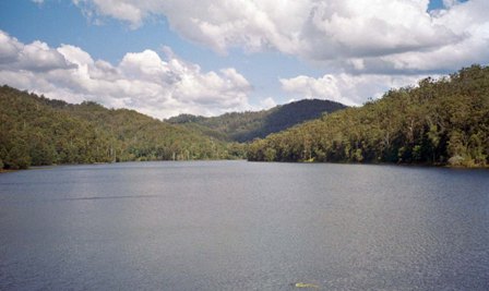
Leave Nimbin crossing Mulgum Creek by the bush theatre. The road undulates through several valleys with views of forested mountains, some with sheer rock faces. As you reach one such cliff face (13 km) turn right to follow the Tweed River (at this stage insignificant in width). The road goes into bush and is intermittently unsealed but well maintained. At Burrell (6 km) there is a small shop and a view of Mount Burrell. From here you have glimpses of Mount Warning's distinctive bare peak straight ahead, and of the nearby forested ranges. After 15 km a short detour to your right will take you to picnic areas at the water storage area and dam wall of Clarrie Hall Dam.
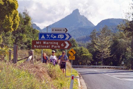
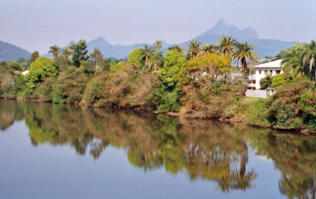
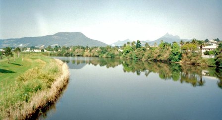
Uki (3 km) is the next settlement, with pub, cafes and supermarket. At Dum Dum (4 km) is the turn off for Mount Warning (it is 7 km to the start of the summit track and a 4.4 km walk to the summit). There is a camping area a kilometre along this road. From here into Murwillumbah the road follows the Tweed which has widened considerably, and the terrain flattens out. Lookmg back there are still views of Mount Warning. Murwillumbah (9 km) has several parks and a long bridge across the Tweed. The mountains are visible all around and are reflected in the river.
Wednesday 15th: Murwillumbah to Pottsville (41 km)
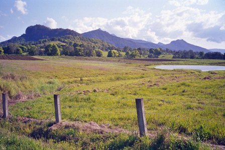
From Murwilluinbah stay on the north bank of the Tweed following Tumbulgum Road past cane fields to Cane Road (2 km), then go right to Condong (1 km) where there is a sugar mill. Go left a few hundred metres on the Pacific Highway then take the first right towards Duranbah and Bogangar. This road continues across the Tweed valley then climbs the forested Farrants Hill. At the top (7 km) take the left fork. This section is unsealed and the views into the Tweed valley are magnificent, Mount Warning clearly outlined to your far left and an isolated rock plonked in the middle of the fields. At the edge of Duranbah (7 km) go left on the sealed road towards Tweed Heads.
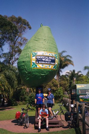
Look out for the large model avocado on your right that signals Avocadoland (3 km). Here you can visit the fruit plantations, have all sorts of tropical drinks in the cafe and purchase fruit and nuts. Just after Avocadoland go right on Cudgen Road to Kingscliff (7 km), which has a long white surf beach, holiday accommodation and milk bars.
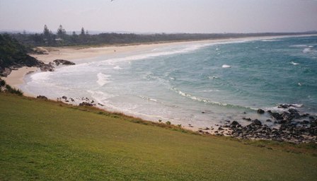
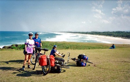
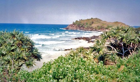
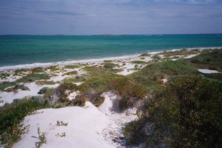
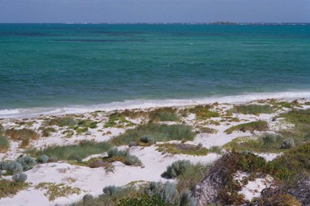
Head south on the Coast Road, passing through a sequence of resorts. There are many beach access points through the dunes between the road and the beach. Bogangar (8 km) has van parks and motels and a headland you can walk onto. Hastings Point (3 km) has tourist facilities. Pottsville (3 km) is situated on Mooball Creek with an ocean beach and sheltered beach; a quiet place to relax after a day's pedalling.

Thursday 16th: Pottsville to Byron Bay (40 km)
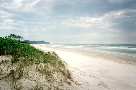
Cross Mooball Creek in Pottsville and continue on the bush flanked coastal road, passing more white beaches. Mooball Beach (6 km) is followed by Wooyung (3 km) which has a camping reserve and motel. From Wooyung you can continue down the coast on a dirt road which starts opposite the camping area; this track offers beach access and grassy picnic areas but is prone to flood and when I was there I had to brave shin-deep puddles that blocked the way. A boat would have been useful. Enquire of locals about the track condition before setting out. (The alternative is to stay on the sealed road to the Pacific Highway (4 km) and then take the highway to Brunswick Heads (9 km).) You reach Golden Beach (3 km) and bear left along the sealed road to New Brighton (3 km) where there is a shop. From here follow signs to Ocean Shores, and after a sharp right turn you cross Brunswick River and climb steeply for views of Cape Byron. Head for the trig point atop the grassy hill ahead of you. You start to descend past the signpost to the lookout. When you reach the next T junction go right and meet the Pacific Highway (3 km). Turn left onto the highway, soon crossing Brunswick River, for Brunswick Heads (2 km). From Brunswick there is no alternative to the highway until Ewingsdale (13 km). Thin left here for a flat ride into Byron Bay (7 km). Byron Bay has become trendy in the last few years. The beaches are superb and the cafes friendly. If you have time and energy do the Lands Department walk around Cape Byron where you will find Australia's most easterly lighthouse. You can also ride to the lighthouse, two kiloinetres from the town centre. Tourist information is available in the literary institute on Jonson Street.
Friday 17th: Byron Bay to Ballina (30 km)
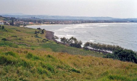
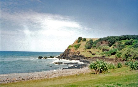
Follow Jonson Street which becomes the Ballina road. The first resort is Suffolk Park (6 km) soon followed by the turn off for Broken Head (2 km); the beaches and reserve are a couple of kiloinetres away and you can ride through coastal rainforest to secluded beaches. The road goes inland passing through bush, cleared land and coastal scrub near Lennox Head (13 km), another surfing resort with hostel, motels and camping. Between here and Ballina are hills as you pass a series of sandy bays separated by grassy headlands, many suitable for a picnic and with fine coast views. At Shelley Beach Road (6 km) go left to the beach which has a grassy reserve alongside, and continue to the lighthouse (1 km). At the car park beyond the lighthouse go left steeply downhill and follow wide Lighthouse Parade. From the coastguard station at the southern end there is a bike path to the centre of Ballina (2 km), first along the top of the breakwater, crossing North Creek and then skirting the town's main park to end at the tourist centre.